
Local details that make a difference
mature canopy between the rail ridge and Ku-ring-gai bushland changes the local service picture
The built form in Warrawee includes large gardens, older homes, schools and tennis-court edges, set within the broader landscape of mature canopy between the rail ridge and Ku-ring-gai bushland. This guide therefore emphasises a protected viewing place, a precise handover point and an approach that does not cross the snake's path.
For the wider service context, see our Blacktown snake removal guide and the Blacktown and Western Sydney service area. This page covers the access and safety details specific to Warrawee.
PET EMERGENCY CONTACTS
Plan the Warrawee vet call before the drive
Ring first, put the phone on speaker if another person is preparing the pet, and follow the veterinary team's directions. Keep the animal calm and reduce walking or struggling as much as possible.
How the surroundings affect a sighting Warrawee
Bushland gullies, sandstone and mature gardens can produce encounters with diamond pythons and smaller forest snakes; wetter creek lines may suit red-bellied black snakes. Venomous species can vary in appearance, so every unknown snake deserves distance.
Diamond python
Can use mature trees, roof spaces, thick gardens, rockwork and sheltered structures.
Do not use this as an ID: Do not approach because a pattern appears familiar; large pythons can still defend themselves.
Australian Museum species guide ↗Golden-crowned snake
A small nocturnal snake associated with moist forest, sandstone, leaf litter, logs and rocks.
Do not use this as an ID: The pale crown can be incomplete or hard to see, and a defensive posture is not a safe ID test.
Australian Museum species guide ↗Red-bellied black snake
Often associated with wetter habitat such as creeks, drains, wetlands and dam margins.
Do not use this as an ID: The red or pink flank may be hidden from view, especially from above.
Australian Museum species guide ↗These are habitat-based possibilities for the wider district, not a claim that any species is common on a particular Warrawee property. The Sydney snake identification guide explains the limits of visual identification.
If you lose sight of it
A safe last location is more useful than a close photograph. Around mature canopy between the rail ridge and Ku-ring-gai bushland, do not follow a snake into vegetation, waterway land, a work zone or another property. Note the last fixed object it passed and call from a safe place.
Do not touch, trap, corner or try to kill the snake. Bring children and pets away and call a trained reptile handler.
LOCAL VISUAL / REGIONAL CONTEXT
Putting the streets in context
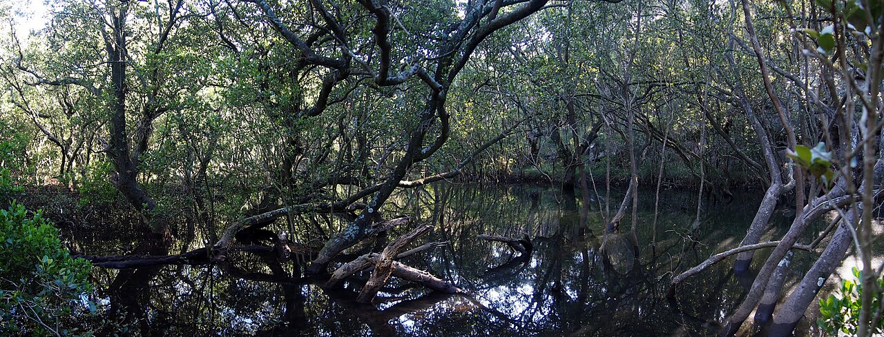
Buffalo Creek — a regional reference for the creek lines and bush corridors threaded through northern Sydney.
Photo: Maurice van Creij / Wikimedia Commons ↗ · CC BY 3.0 ↗. Cropped for display.
Warrawee map: use this to check the wider road, reserve and waterway pattern—not to approach a snake. Provider attribution appears inside the map.
Getting the catcher to the scene
For Warrawee, give the driveway, school gate, side path and garden level. Say whether the snake is indoors, outdoors or moving towards mature canopy between the rail ridge and Ku-ring-gai bushland, and nominate one person who can meet the catcher without passing the sighting point.
Let us know whether the snake is inside or outside, whether a gate or door is locked and whether animals are still on the property.
snake sighting around large gardens, older homes, schools and tennis-court edges
movement towards mature canopy between the rail ridge and Ku-ring-gai bushland
call requiring the driveway, school gate, side path and garden level
PET SAFETY / DETAILS CHECKED 28 AUGUST 2026
A practical vet reference
For Warrawee, Hornsby Veterinary Hospital is shown as the researched local contact and North Shore Veterinary Hospital as the all-hours regional fallback. Each listing links to the provider's official information.
The Artarmon hospital states that it is open 24/7 for emergencies.
Local Hornsby clinic; its site lists an after-hours referral.
These entries were checked on 28 August 2026. They support quick decision-making but do not promise that either service is the nearest available from a particular address at the moment you call.
Independent contact information only. Snake Catcher Sydney Wide is not affiliated with these veterinary providers. In a life-threatening pet emergency, follow the veterinary team's instructions immediately.
A few questions on the call
We will ask where the snake was last seen, what sort of property it is and the safest place to meet you. An existing photo can be useful, but nobody should move closer to take one. Once we know the situation, we can give you an honest indication of availability and travel time.
Tidying without overdoing it
After the immediate risk has passed, inspect door seals and screens, keep frequently used paths visible, lift stored materials off the ground and reduce rodent food around large gardens, older homes, schools and tennis-court edges. Leave creek, foreshore and reserve habitat undisturbed.
No property can be completely snake-proof. The practical aim is better visibility, fewer hiding places and less food for rodents, without harming native wildlife.
Call 000 immediately. Keep the person still and calm, apply a pressure immobilisation bandage, and do not wash, cut or suck the bite. Follow the emergency operator and Healthdirect guidance ↗.
Quick local answers
Answers for Warrawee
Does mature canopy between the rail ridge and Ku-ring-gai bushland mean snakes are common in Warrawee?
No. It is a verified local landscape reference, not a frequency claim. Habitat, weather and individual properties vary, so every unknown snake should be given space and assessed from the actual sighting.
Do I need pest control or a snake catcher?
If you are searching for pest control or pest removal because you have found a snake, contact a licensed snake catcher directly. A pest-control business that does not provide licensed snake handling may need to refer your call, adding a step and potentially delaying arrangements. Some pest controllers also offer licensed snake catching; ask whether they can arrange an appropriately licensed handler. Keep people and pets away and call Snake Catcher Sydney Wide to confirm the fee, availability and estimated arrival.
What if the snake has already moved on in Warrawee?
Tell us where it was, when it was seen and which way it went. Do not search dense plants, roof spaces, cupboards or stored material yourself.
What if somebody may have been bitten?
Call 000 immediately, keep the person still and follow the emergency operator's instructions. Do not wait for a snake catcher before seeking medical help.
The local background comes from Hornsby Shire Council — parks and bushland plans ↗, with snake safety checked against NSW Environment guidance ↗. The embedded public map is used to confirm the suburb, roads and named landscape reference. Habitat can vary from street to street, so we do not claim that a particular species is common at any address.